Some of the best stories start with a map. Take The Goonies, for example—a bunch of kids find an old treasure map and end up on the adventure of a lifetime. Twists, traps, pirate gold—all because they followed the trail.
You might not be chasing treasure, but every hike, trail run, bike ride, or mountain climb has the potential for a little adventure. And these days, you don’t have to hope for a long-lost map in a dusty basement. With just a phone or watch, you’ve got everything you need for your own outdoor quest.
But having a digital map isn’t much use if you haven’t planned your route properly. It’s all too easy to fall into the “we’ll just figure it out” trap, only to end up lost, exhausted, or missing the best parts of the trail. A little planning goes a long way.
If you're dreaming of a challenging mountain ascent, a leisurely bike tour, or even a revitalizing trail run, let's explore how embracing the planning process can amplify the joy of your outdoor pursuits. Get ready to unlock the potential for discovery and anticipation that lies within every map, every data point, and every carefully considered step. Let the adventure in planning begin!
Tailoring your goals and strategy
When you begin to really plan your adventure, crafting your goals and strategy is about taking that big dream and figuring out how to make it a reality. That prep work includes planning your route.
Yes, we’ve all been Sarah sometimes. The thrill of spontaneity, the freedom of just lacing up and heading out—it’s part of the magic. And there’s absolutely room for that kind of improvising. Some of the best moments on the trail happen when you take a turn just because it looks interesting, or when you stop to soak in a view you didn’t expect.
But here’s the thing: even a little bit of planning can make those spontaneous moments safer, more enjoyable, and way less stressful. So, Sarah sat down and refined it. Her specific goal became: "Complete the 15-mile loop to Eagle Peak with a target time of 4 hours by the end of next month." Now, that's something she can work with.
With a clear destination in mind, the strategy starts to unfold. She looked at the trail map, noting the significant elevation gain in the first five miles. Sarah's strategy then involved incorporating hill repeats into her weekly workouts, focusing on building endurance on varied terrain and researching potential water sources along the route. She even planned a shorter practice run on a similar section of the trail to get a feel for the conditions.
Then there's Mark, a seasoned backpacker envisioning a multi-day trek through a national forest. His broad goal was "Hike for three days." To make it a successful and enjoyable adventure, he, of course, needed to delve deeper. His specific goals included covering approximately 10 miles daily, finding established campsites with reliable water sources marked on the map, and summiting a particular viewpoint on the second day.
His strategy involved meticulously studying topographic maps to understand the terrain and potential challenges, planning his daily mileage based on elevation changes and daylight hours, and identifying backup water sources in case the primary ones were dry. He even factored in potential weather changes and packed layers accordingly.
See the difference? Clear goals provide direction, and a well-thought-out strategy acts as your compass and toolkit. It allows you to anticipate challenges, train effectively, and ultimately, savor every breathtaking moment of your adventure.
undefined
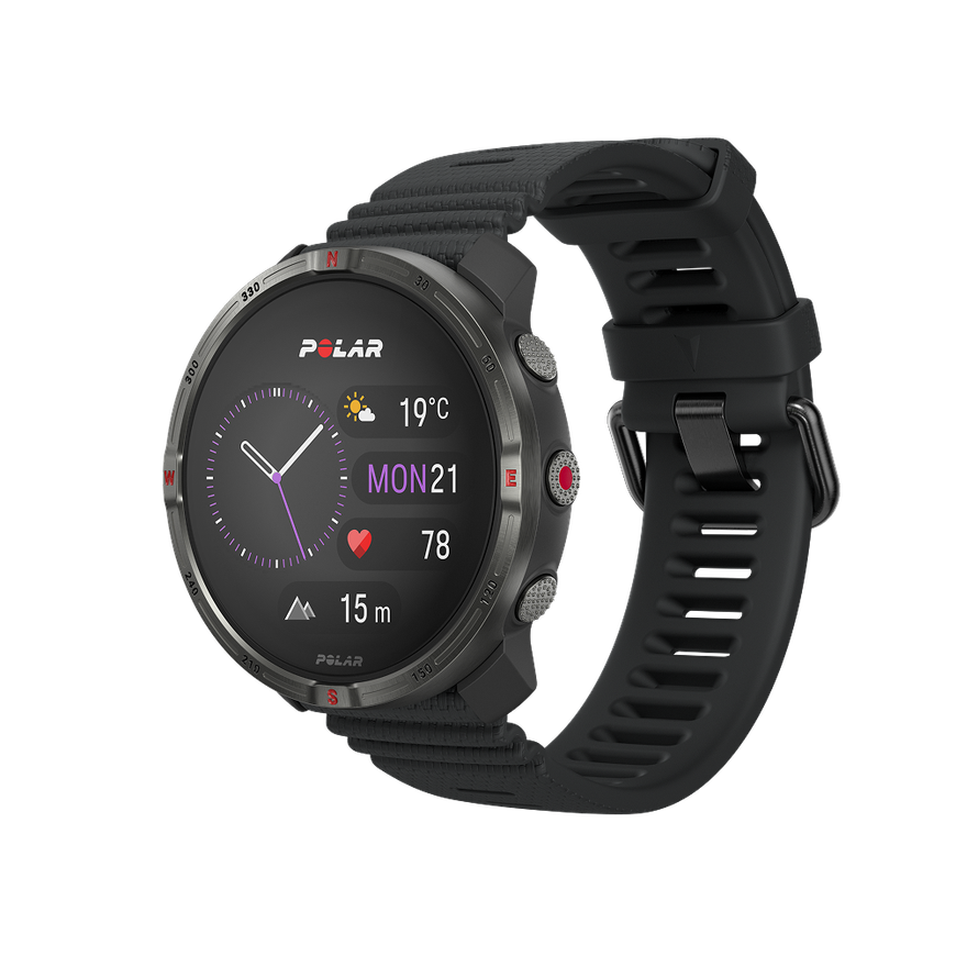
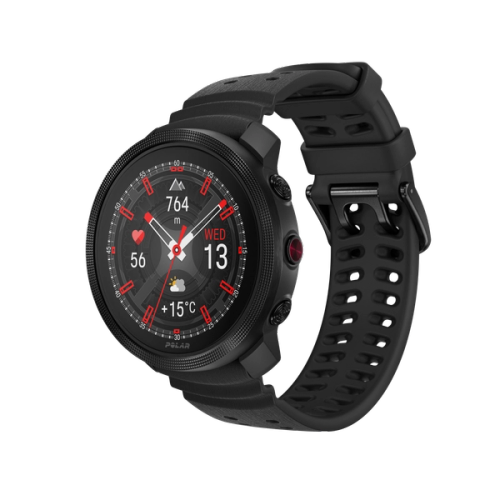
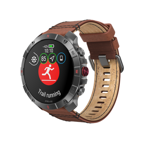
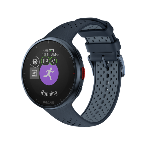
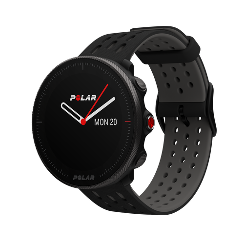
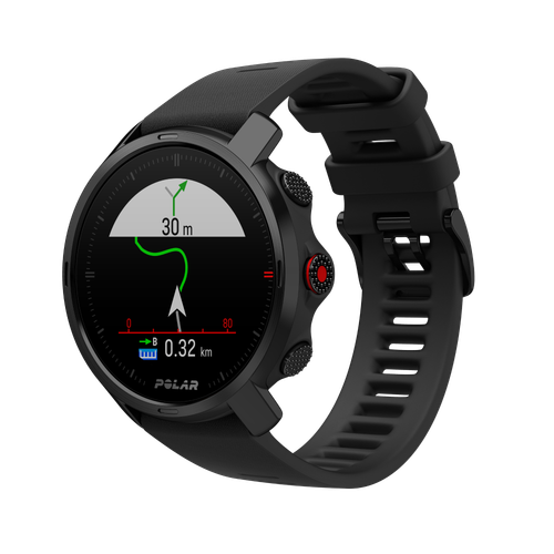
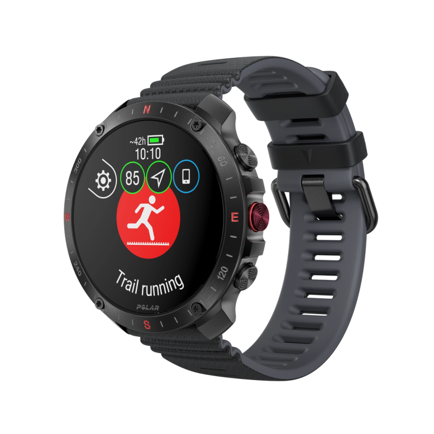
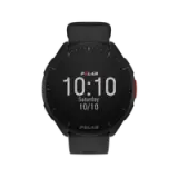
Polar Grit X2
戶外手錶
Polar Grit X2 是一款小巧堅固的戶外手錶,精心打造,無論極限冒險挑戰,還是日常活動,皆能完美應對。擁有先進的訓練工具、藍寶石玻璃 AMOLED 螢幕,以及配備全彩地圖的精準導航功能,無論行山越野,還是日常生活,這款手錶都能完全勝任。
Discover Polar Journal
Polar Journal is a space for stories that inspire movement. Each edition blends practical training tips, sports science, and inspiring journeys from athletes and those who live and breathe an active life.
Read Polar Journal
Route planning 101
In today’s digital age, smart route planning is easier—and safer—than ever. With the right tools, you can map out your adventure, stay on course, and feel confident every step of the way. Best of all, you can take your map with you—right on your wrist. No need to worry about phone coverage or getting lost; your Polar watch lets you access your route offline, anytime.
Up next, we’ll walk through a few simple tips to help you plan your route and make sure everything’s ready to go on your Polar watch.
Here’s what you’ll need:
- A route planning app
- Polar Flow app to sync your routes
- A Polar watch with built-in maps and offline navigation
Let’s start by looking at some apps for route planning. These days, we have a fantastic array of mapping tools at our fingertips. Apps like Strava and Komoot offer interactive maps with user-generated insights, elevation profiles, and even downloadable offline versions—invaluable when you’re off the grid. These tools often let you plot your desired route by considering distance, elevation gain, and points of interest, all right on your phone or computer.
Routes you create in Strava or Komoot sync seamlessly with the Polar Flow app. The connection works quietly in the background, so just moments after you build your route, it’ll show up in Polar Flow—no extra steps needed. From there, all it takes is a quick sync with your watch, and boom—you’ve got the route right on your wrist, ready to go.
Routes you create in Strava or Komoot sync seamlessly with the Polar Flow app. The connection works quietly in the background, so just moments after you build your route, it’ll show up in Polar Flow—no extra steps needed. From there, all it takes is a quick sync with your watch, and boom—you’ve got the route right on your wrist, ready to go.
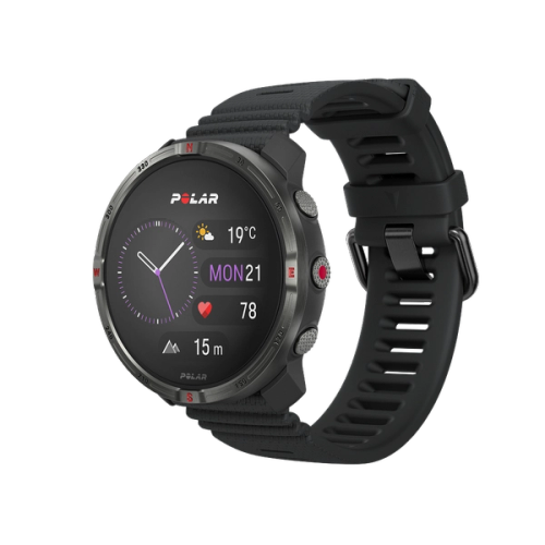
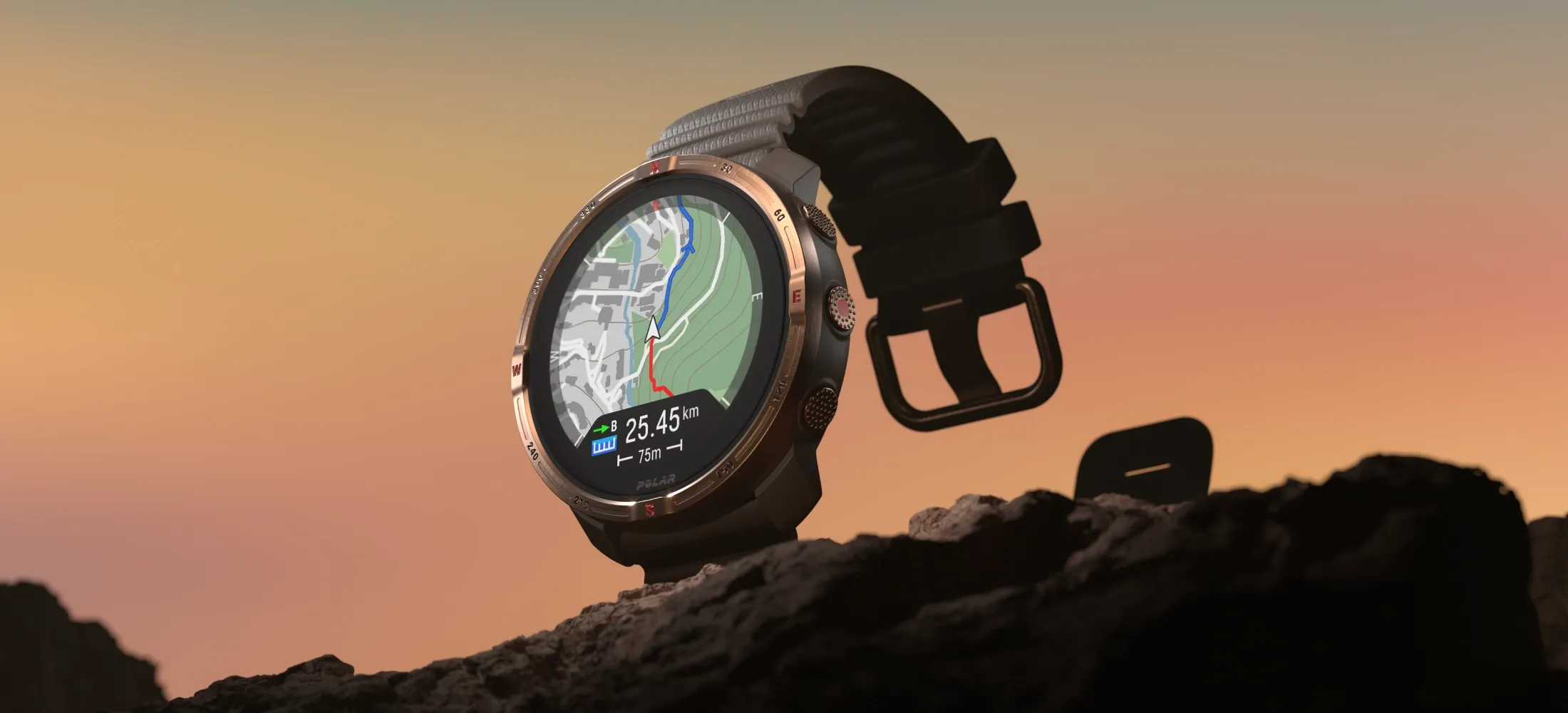
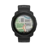
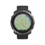
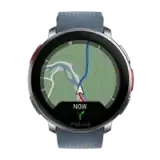
Imagine trekking through a dense forest—just a flick of your wrist, and you can see exactly where you are and where you’re headed. Turn-by-turn guidance, upcoming twists in the trail, and your planned route are all right there on your Polar Watch. No need to pull out your phone every few minutes; your map is always just a glance away. All recent Polar watches, including the Polar Vantage V3, Vantage M3, Grit X2, and Grit X2 Pro, come equipped with offline maps to keep you on track, even when you're off the grid.
In addition to maps, the digital compass—built right into Polar watches—is another invaluable tool. In dense forests or unfamiliar terrain where trails can become unclear, a compass paired with your map gives you vital directional awareness—helping you stay on course when landmarks vanish into the trees.
Enjoying this article? Subscribe to Polar Journal and get notified when a new Polar Journal issue is out.
Subscribe
Navigating different terrain
Successfully getting from point A to point B isn’t always enough—especially when you’re venturing into forests or mountains. A single route can start as a gentle, grassy trail, then shift into rocky, uneven terrain, and eventually climb a steep slope covered in loose stones. Planning for those changes in elevation and surface can make all the difference between a great adventure and a tough day out.
Apps like Gaia GPS and Caltopo allow you to analyze terrain in detail. They offer slope angle shading, which visually highlights steep areas and can even provide insights into aspects, helping you anticipate snowmelt or sun exposure. Many of these apps also let you create custom routes and analyze the elevation profile.
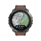
And of course, your Polar Watch isn’t just for following a route. With features like Route and Elevation Profiles, you can track key metrics like ascent, descent, elevation gain, and slope gradients in real time. Whether you’re grinding up a mountain pass or cruising downhill, these insights help you pace yourself, monitor effort, and better understand the terrain. It’s like having a personal guide on your wrist, giving you the data you need to move smarter and go further.
Elevation
When plotting your next adventure, challenge, or workout, understanding and planning for elevation changes is absolutely key. It can be the difference between a triumphant summit and a grueling slog. Let's talk about how to master the ups and downs.
Remember Mark and his hike? His initial route looked fantastic on a flat map, but when he consulted the elevation profile on Komoot, his eyes widened. The gentle-looking trail actually included a relentless 1500-foot climb on the second day. Realizing this, Mark adjusted his strategy. He incorporated more hill training into his preparation and planned for a shorter mileage day to account for the extra effort. He also packed electrolyte supplements to help his body cope with the exertion at higher altitudes.
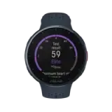
The latest Polar Watches are equipped with Vertical Ascent Meter (VAM) metrics, showing his rate of ascent in meters per hour. By analyzing the VAM data from previous rides on similar terrain, he could estimate his climbing speed for different sections of his planned route. This allowed him to set realistic time goals for reaching certain points and manage his effort effectively, preventing early burnout.
So, what tools can help you conquer those vertical challenges? Topographic maps, both paper and digital, are your first allies. Contour lines, those squiggly lines you see, indicate changes in elevation. The closer the lines, the steeper the terrain. Digital mapping platforms like AllTrails, Gaia GPS, and Strava often display detailed elevation profiles for routes, allowing you to visualize the climbs and descents ahead. Many even provide cumulative elevation gain and loss, crucial metrics for gauging the overall difficulty.
Your sports watch is another invaluable tool. Many now have barometric altimeters that provide accurate real-time elevation data, ascent/descent rates, and even alerts for significant elevation changes. This live feedback helps you manage your effort and stay informed about the terrain ahead.
undefined
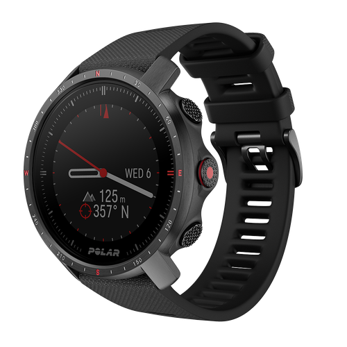
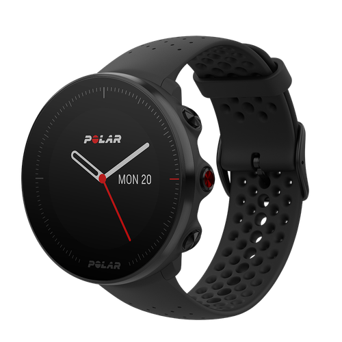
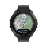
Polar Grit X2 Pro
頂級戶外手錶
Polar Grit X2 Pro 專為冒險而設計,是一款堅固耐用的戶外運動手錶,配合藍寶石水晶玻璃 AMOLED 螢幕,以及全套以導航與表現追蹤為本的高科技功能,助您探索精彩世界,同時清晰了解自己的體能狀況。
Viewpoints and landmarks
Viewpoints and landmarks aren't just pretty spots. They can be fantastic motivational markers, navigation aids, and opportunities to soak in the beauty of your surroundings.
Think of Mike and his challenging uphill hike. Instead of just focusing on reaching the summit, he meticulously studied his map and noted a prominent waterfall halfway up and a breathtaking vista just before the final push. These weren't just waypoints – they became mini-goals, providing a sense of accomplishment as he reached each one. The roar of the waterfall offered a refreshing break, and the panoramic view fueled his determination for the final ascent.
Planning for viewpoints and landmarks involves a bit of detective work and a sprinkle of artistic vision. Most mapping platforms often highlight points of interest (POIs), including viewpoints, historical markers, unique rock formations, and other notable landmarks. User photos and descriptions can give you a real sense of what to expect and help you decide if a particular spot is worth including in your route.
When integrating viewpoints and landmarks into your route, consider their placement. Are they well-spaced to provide regular breaks and visual rewards? Can they serve as reliable navigation points, especially in less-marked terrain? Think about the direction of view and the best time of day to experience it. A sunrise vista might require an early start, but the reward could be unforgettable.
When you're out and about, Polar watches running PolarOS 3.0 or later come equipped with a super useful Points of Interest (POI) feature. Whether you're in training mode or just out exploring, POI lets you spot key locations on your map or guides you straight there with a beeline route and real-time distance tracking. You can even set your own custom POIs and navigate to them with pinpoint accuracy—anytime, whether during a workout or just wandering off the beaten path.
Ready for adventure? Read our Trail Running Guide
Polar Guide: Trail Running
Go your own way
With current exploring with confidence has become easier than ever. Beyond just distance and pace, tools like your sports watch and digital apps provide a wealth of data that can help you strategize smarter and conquer those trails with newfound insight.And honestly, there’s something undeniably cool about glancing at your wrist and seeing your adventure unfold turn by turn—like having a personal guide tucked into your gear.
Enjoying this article? Subscribe to Polar Journal and get notified when a new Polar Journal issue is out.
Subscribe
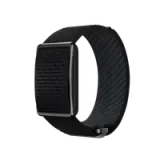
 Polar Vantage M3
 Polar Grit X2 Pro Titan
 Polar Grit X2 Pro
 Polar Grit X2
新品上市
Polar Grit X2
新品上市
 Polar Vantage V3
 Polar Ignite 3
 Polar Pacer Pro
 Polar Pacer
 Polar Unite
Grit X 系列
Vantage 系列
Pacer 系列
Ignite 系列
Polar Unite
Grit X 系列
Vantage 系列
Pacer 系列
Ignite 系列